
Engineered in Idaho · Public Safety UAS Engineering
Aerial Response Systems develops unmanned aircraft and mission technology for public safety organizations.
We are an Idaho-based engineering company designing UAS platforms, sensor systems, mission software, and operational intelligence capabilities for search and rescue, law enforcement, fire, emergency management, and disaster response.
Our current work includes direct engineering research with public safety professionals so future capabilities are shaped by real operational experience rather than assumptions.
Engineering research only · No sales presentation · No purchasing commitment
RID
Remote ID aware
Designed for broadcast detection
ADS-B
Traffic context
1090 MHz reception on the bench
CoT
TAK output
Built around operator workflows
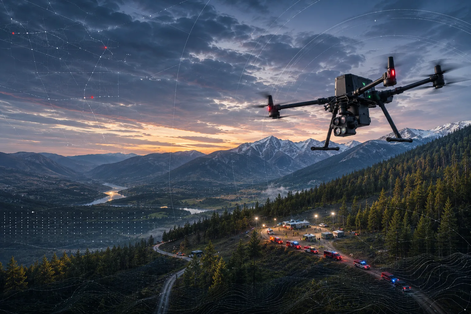
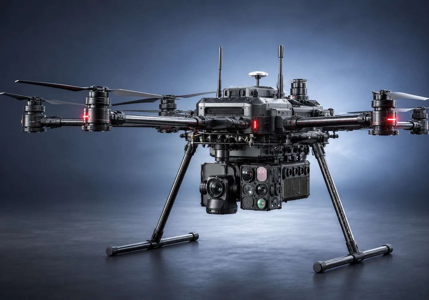
Concept visual
ARS Phoenix mission payload concept
Signal domains: maturity varies
04
Signal domains in the design
TAK
Interop target
Human
Operator keeps command authority
Engineering Research
Help Shape the Future of Public Safety Aviation
ARS is interviewing public safety UAS professionals, pilots, program managers, incident commanders, and operational leaders to better understand mission workflows, capability gaps, and unmet engineering needs.
These conversations are not sales presentations. We are not requesting procurement information or asking agencies to evaluate a finished product. The purpose is to collect operational insight that can guide engineering priorities, system requirements, and future validation.
Why ARS Exists
Public safety teams do not need more disconnected data. They need clearer operational decisions.
Public safety UAS missions often depend on separate aircraft, thermal cameras, mapping tools, weather feeds, airspace data, responder locations, and communications systems. Operators are left to interpret and reconcile those inputs under time pressure.
ARS is developing systems intended to help transform fragmented mission data into a more coherent operational picture for pilots, responders, and command personnel — without replacing the judgment of the people in command.
Sense -> Fuse -> Inform
How that operational picture gets built
ARS is engineering the connective layer between raw aerial signals and the people responsible for mission judgment. Each layer is designed to be useful on its own and stronger as a system.
01 / Sense
Detect the mission environment
Remote ID, ADS-B, RF spectrum, thermal signatures, GPS reference, and flight telemetry are designed to be treated as independent signals that can be compared and challenged.
02 / Fuse
Build one trustworthy picture
ARS correlation and plausibility logic is designed to reduce noise, identify anomalies, and assemble a shared operating picture for the people making decisions.
03 / Inform
Put context in front of each role
Mission displays and TAK/CoT output are designed to give operators, aviation teams, and command staff the right level of information without taking authority away from them.
Mission Operating System for Public Safety Aviation
Built for the workflows around the aircraft, not just the aircraft itself
Public safety UAS teams need more than a live camera feed. They need airspace context, mission evidence, role-specific displays, and interoperability with the command tools already in use. ARS is organizing those capabilities into one advisory-first platform direction.
System preview
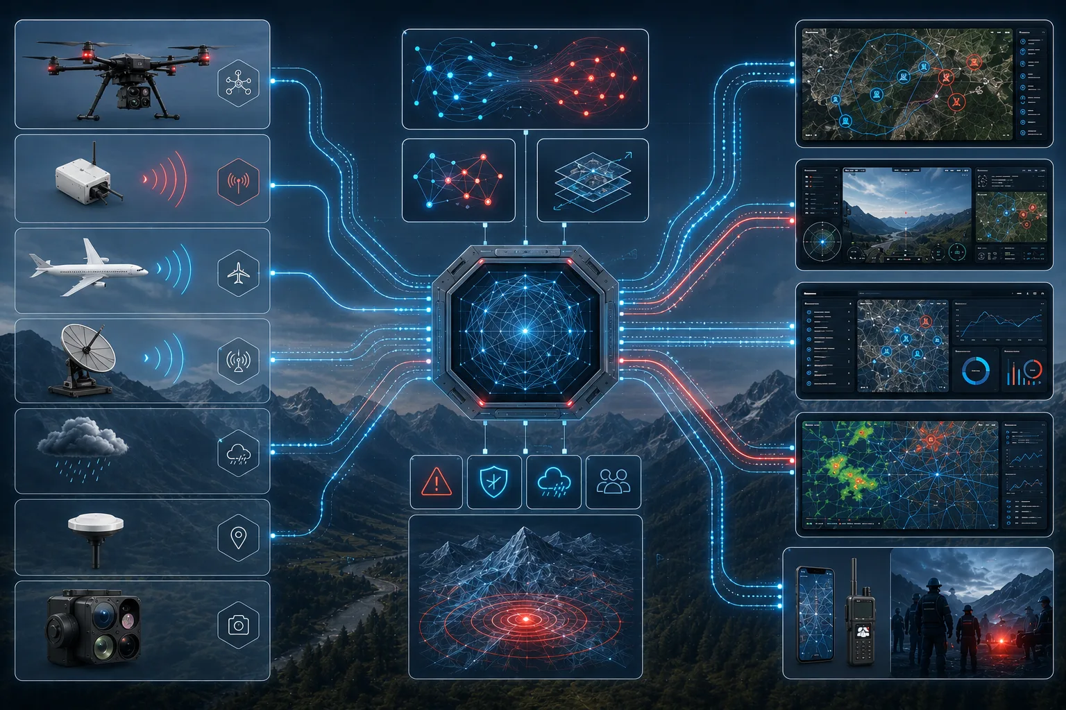
Mission data pipeline
Operational Ecosystem
A shared architecture for aircraft, sensors, decision support, and mission displays
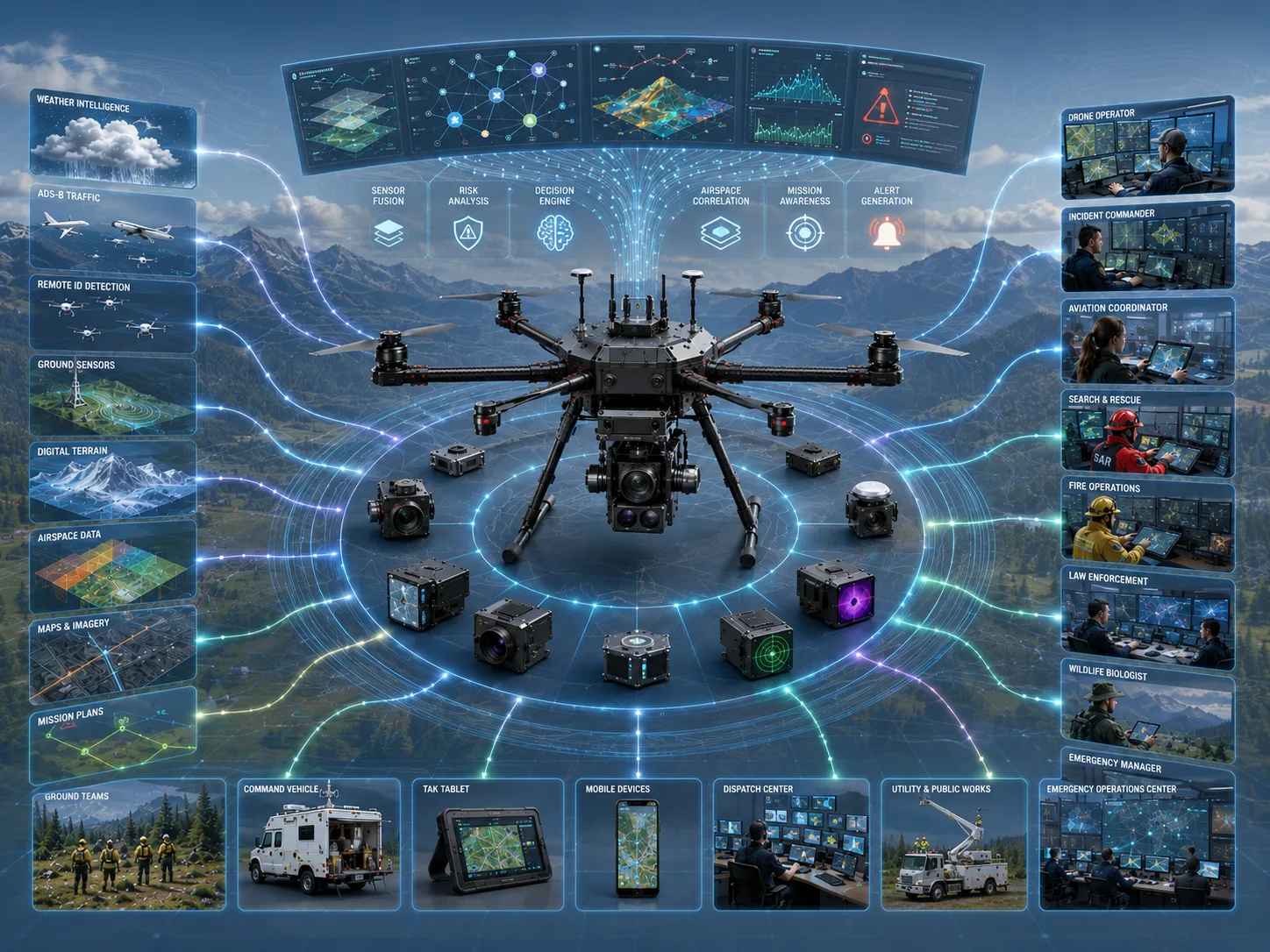
These concept visuals show the broader operating model: sensing payloads, advisory engines, TAK-oriented interoperability, and role-specific displays connected through one mission data layer.
Concept visual
ARS unified operational ecosystem
Common Operational Picture
One data model, different views for each mission role
The same underlying information can support operators, aviation teams, and command staff without forcing each role into the same interface. The visual below is conceptual and preserves ARS’s advisory-first development posture.
Concept visual
Common operational picture
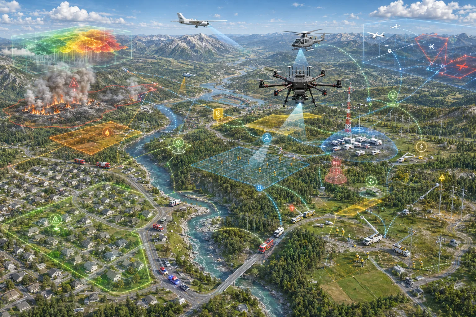
Mission Profiles
One platform direction, tuned for the realities of each response role
These previews frame where ARS technology is being aimed. They do not imply production deployment or agency adoption.
Law Enforcement
Unauthorized drone awareness, scene geofence context, and TAK-native contact sharing for patrol and tactical operations.
View mission profile
Search and Rescue
Search-sector prioritization and thermal-assisted detection designed around time-limited backcountry missions.
View mission profile
Fire Operations
Thermal hotspot cues, perimeter awareness, and command-ready context for wildfire and structure fire response.
View mission profile
Aviation Operations
Manned traffic awareness and advisory weather context for UAS teams operating near aviation constraints.
View mission profile
Incident Command
Executive-level status, active advisories, and mission phase visibility without raw operator display clutter.
View mission profile
Wildlife / Conservation
Low-disturbance aerial survey concepts for terrain coverage, thermal counts, and conservation operations.
View mission profile
Mission Displays
Interface concepts for the people around the mission
The next visual layer for ARS is role-specific displays: operator views, command summaries, and aviation-aware advisory screens generated from the same shared data model.
UAS Operator
Live sensor and aircraft status
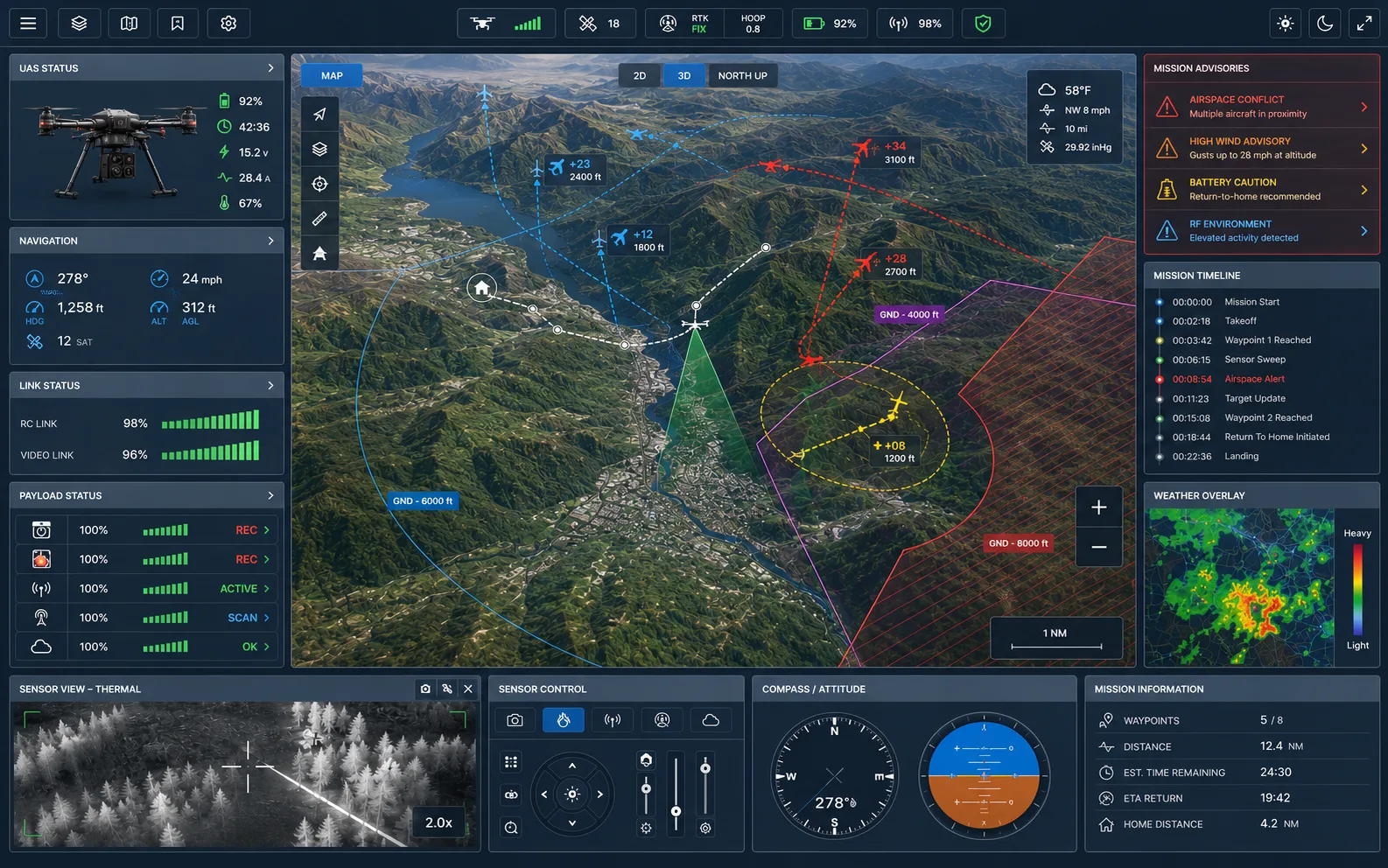
Concept interface with illustrative values; not output from a deployed system.
- Airspace tracks
- 04 active
- Nearest contact
- 340 m
- Link state
- Nominal
Incident Command
Mission posture overview
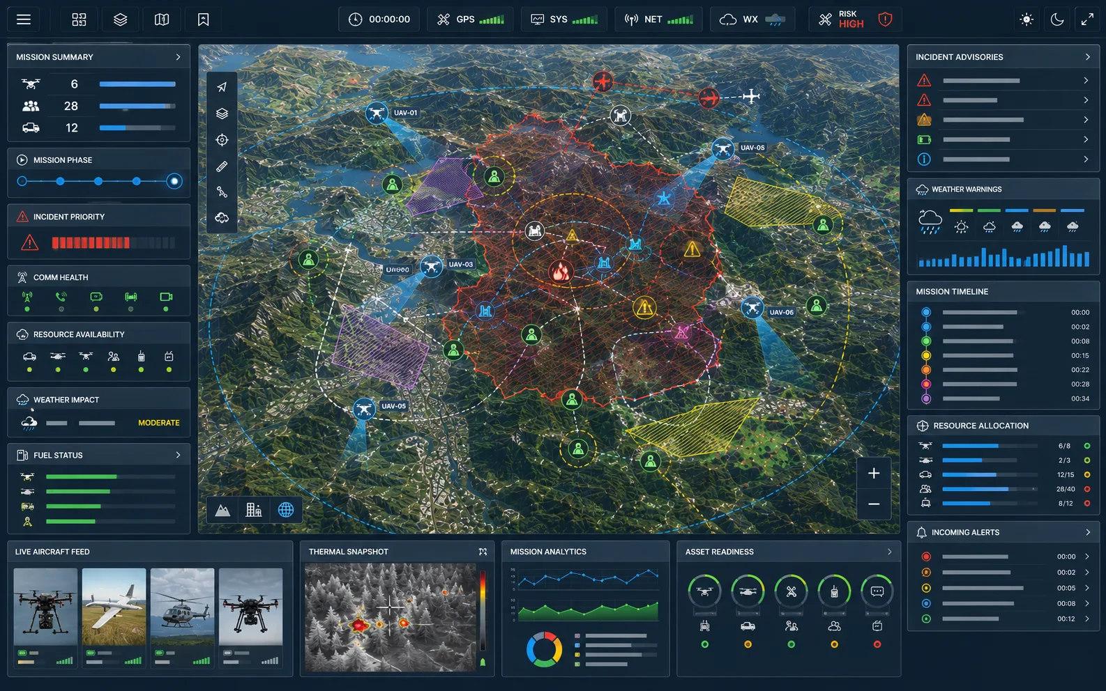
Concept interface with illustrative values; not output from a deployed system.
- Assets on scene
- 02 UAS
- Mission phase
- Search
- Priority advisory
- None
Aviation Ops
Traffic and weather advisory
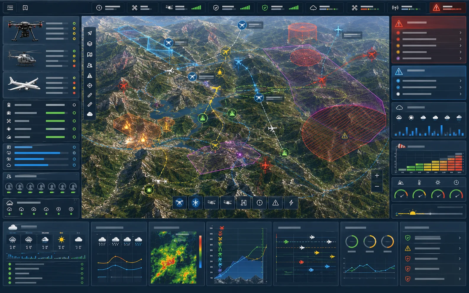
Concept interface with illustrative values; not output from a deployed system.
- ADS-B traffic
- 01 nearby
- Weather gate
- Review
- Operator action
- Manual
Development Philosophy
Premium technology storytelling, without overstating maturity
ARS presents its systems as prototype, active engineering, or validation-stage technology only where the evidence supports it. The product experience should look serious because the mission is serious, while staying precise about what is available today.
Bring your operational experience into ARS engineering
Tell us about your agency, aviation operation, or public safety use case. We'll ask about your real mission workflows and share where ARS engineering stands today — no sales pitch, no purchasing commitment.